ORACLE
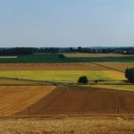
The ORACLE / BVRE Orgeval Observatory (Representative and Experimental Watershed) is a system of observation and experimentation located 70 km east of Paris (France), since 1962. As such, i) it produces continuous and long-term observations, multi-variables and multi-scales, of a set of embedded sub-basins (1km² to 1800 km²) and ii) hosts a set of experimental devices related to the observation of the environment. Representative of sedimentary agricultural basins, it is characterized by a temperate oceanic climate on which west atmospheric circulations are dominant (674 ± 31 mm cumulative annual rainfall with low events spread over the year, 642 ± 20 mm of potential evapotranspiration, and an average temperatures of 11 ° C). Constituted with a relatively flat plateau (Alt 140 m am.l.), it is incised by the rivers of Grand Morin and Petit Morin (Alt 100m) (0.6 to 5.65 m3/s of annual flow, floods from 26 to 88.6 m³/s and low flows from 0.02 to 1.7 m³/s). It is covered with quaternary eolian deposits (up to 10 m thick), consisting mainly of low permeability sand and silt lenses. Several aquifers are associated with stratified tertiary formations (Eocene and Oligocene). The watersheds observed are important because they influence the water supply of the Paris conurbation, both quantitatively and qualitatively. Its configuration in embedded watershed makes it possible to answer the questions of change of scale. Finally, the precedence of its observations over more than 50 years, France’s oldest environmental observation system, makes it possible to answer the questions of global changes.
Its objectives are:
1. To provide long-term observations of the environment, scientific and operational bases on the functioning and dynamics of agricultural watersheds through the management of the instrumentation (81 measurement stations on 60 geo-referenced sites) and data (https://bdoh.irstea.fr/ORACLE/);
2. To implement the observations that make it possible to establish hydrological, biogeochemical, energy and biological balances. A global and integrative observation of the environment allows the understanding and the modeling of the system (Critical Zone and watersheds) for scientific as well as operational purposes (which adjustments against the risks, floods and droughts, water quality, all in preserving biodiversity and human activities?). Monitoring these balances over the long term to understand their dynamics (periodicity, stationarity) in the face of climate change and anthropogenic development;
3. To develop the instrumentation and measurement necessary for the long-term observation of the environment, either in the context of research or in the operational and industrial context.


